
Business Details
44 Years
experience
Expert Mining Survey Services in Exeter
Established in 1982, Merrett Mining Surveys has built a reputation as a leader in advanced mining survey solutions. Our expertise spans exploration, infrastructure development, and operational support for opencast and underground mining projects worldwide. With a foundation in mining engineering from the Camborne School of Mines, we combine decades of practical experience with cutting-edge technologies like LiDAR, UAV drones, and 3D BIM modelling. Our global reach extends to over 60 countries, delivering precise, cost-effective surveys tailored to diverse terrains and climates. We specialise in high-accuracy measurements for mineral extraction, stockpile volume calculations, and environmental monitoring, ensuring safety and efficiency across all project phases.Our teams deep understanding of mining operations, coupled with early adoption of GPS and laser scanning innovations, positions us as trusted partners for complex surveying challenges. From initial exploration planning to final site decommissioning, we provide comprehensive data-driven insights that optimise project outcomes. Our commitment to technological advancement is matched by a dedication to client collaboration, offering bespoke solutions for both new ventures and ongoing operations. With offices in Devon, UK, we serve clients across Africa, Asia, Europe, the Middle East, and the Americas. As pioneers in mobile mapping and underground laser scanning, we continue to set industry standards for precision and reliability in mining surveying.

Services
Infrastructure Surveys
Opencast Mining Surveys
Underground Mining Surveys
Quarry Surveys
Cadastral Surveys
Exploration Services
Mineral Processing Surveys
Stockpile Volume Surveys
LiDAR Scanning
UAV Drone Surveys
Details
- Year established: 1982
Highlights and features
- We have 40 years of experience in mining surveying since 1982.
- Our team operates in over 60 countries with global expertise.
- We utilise cutting-edge LiDAR and drone technologies for precision surveys.
- Our surveys support all mining project stages from exploration to decommissioning.
- We provide cost-effective solutions tailored to complex terrains and climates.
Services
Underground Mining Surveys
Our underground mining surveys utilise handheld SLAM laser scanners to create precise 3D models of mine shafts and tunnels. This technology enables rapid data collection by simply walking through sites, ensuring accurate measurements for equipment installation and structural monitoring. We specialise in assessing overbreak, underbreak, and pillar stability to enhance operational safety.
LiDAR Scanning
LiDAR scanning services provide high-resolution topographic data for mining and quarrying projects. Our aerial and ground-based systems penetrate vegetation to reveal terrain features, supporting exploration planning and infrastructure development. This technology delivers survey-grade precision for volume calculations and site analysis.
Opencast Mining Surveys
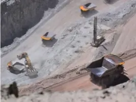
Opencast mining surveys offer detailed measurements of surface mining operations, including area and volume calculations. We employ vehicle-mounted laser systems and UAV photogrammetry to monitor site progress and optimise resource extraction. These surveys ensure compliance with environmental regulations and operational efficiency.
Exploration Services
Our exploration services use LiDAR and GPS technologies to identify mineral deposits and plan drilling programmes. We generate digital terrain models for geological analysis, helping clients evaluate ore body potential and plan infrastructure. These surveys support informed decision-making for new mining ventures.
Stockpile Volume Surveys
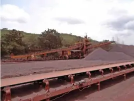
Stockpile volume surveys employ drone-based photogrammetry and laser scanning to calculate material quantities. This service ensures accurate inventory management for minerals like coal, iron, and aggregates. Our rapid data collection minimises operational downtime while maintaining measurement precision.
People
Peter Merrett
Founder
Peter Merrett trained as a Mining Engineer at Camborne School of Mines before founding Merrett Mining Surveys in 1982. With 40 years of industry experience, he pioneered the use of GPS and laser scanning technologies in mining surveys, establishing the company's global reputation for innovation.
Questions
What mining survey services do you offer?
We provide underground and opencast mining surveys, LiDAR scanning, stockpile volume calculations, exploration services, and infrastructure surveys using advanced technologies.
Which countries do you operate in?
We operate in over 60 countries across Africa, Asia, Europe, the Middle East, and the Americas, with projects in locations like Greenland, Liberia, and Ecuador.
What technologies do you use?
We utilise LiDAR, UAV drones, GPS, mobile laser scanning, and 3D BIM modelling to deliver precise surveying solutions for mining operations.
How long have you been in business?
Merrett Survey has provided mining survey services since 1982, celebrating 40 years of operation in 2022.