
Business Details
15 Years
experience
Emergency
services
Chartered Land Surveyors in Ashford, Kent
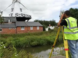
Established in 2011, R L Surveys is a family-run chartered land surveying practice based in Ashford, Kent. With over two decades of industry experience, our team specialises in delivering precise topographical surveys, measured building surveys, and boundary resolution services across Kent, London, Essex, Sussex, and Surrey. We utilise cutting-edge technologies like 3D laser scanning to provide tailored solutions for construction, redevelopment, and monitoring projects of all scales. Our commitment to accuracy and repeatability is demonstrated through the deployment of advanced GPS and total station equipment, ensuring compliance with professional standards.As a regulated firm, we maintain rigorous annual reporting on insurance, training, and client safeguards. Our surveyors have collaborated with leading developers, contractors, and planners on high-profile projects such as the Ashford Design Outlet and Eurotunnel infrastructure monitoring. We offer competitive tenders for UK-wide surveying requirements while maintaining the personal service expected of a family business. Our investment in a Leica C10 ScanStation enables rapid data collection at 1 million points per second, supporting detailed 3D modelling for architectural and engineering applications.
Services
Land/Topographical Surveying
Measured Building Surveys
3D Laser Scanning
Boundary Resolution
Structural Monitoring
Details
- Year established: 2011
Highlights and features
- We offer 20+ years of chartered surveying expertise
- Our family-run business guarantees consistent service delivery
- We utilise Leica C10 ScanStation for high-precision 3D data collection
- We provide competitive tenders for nationwide surveying requirements
- Our team maintains RICS professional standards and annual compliance
Associations and certifications
- Royal Institution of Chartered Surveyors (RICS)
Services
Land/Topographical Surveying
Our land surveyors create detailed 2D/3D plans for construction and redevelopment projects using traditional and GPS methods. We provide accurate elevation data, feature mapping, and boundary verification services. With two decades of experience, we support developers and contractors with survey solutions that meet planning and engineering requirements across diverse terrains.
3D Laser Scanning
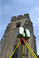
We utilise Leica C10 ScanStation technology to capture millions of data points per second for precise 3D modelling. This non-intrusive method creates detailed point clouds for architectural analysis, structural assessments, and heritage preservation. Our scanning services support engineering projects requiring high-accuracy spatial data without compromising traditional surveying precision.
Measured Building Surveys
Our team produces accurate floor plans, elevations, and cross-sections through internal building measurements. These surveys support architectural redesigns, property valuations, and structural assessments. We tailor deliverables to client needs, providing scaled drawings that document existing building conditions for commercial and residential properties.
Boundary Resolution
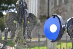
We resolve property boundary disputes using GPS and total station surveys compared with Ordnance Survey and Land Registry data. Our services include boundary demarcation, lease plan preparation, and title plan analysis. We provide professional opinions to clarify grey-area boundary issues for land transfers and development projects.
Structural Monitoring
We implement accurate monitoring systems for short-term and long-term structural assessments. Using repeatable measurement techniques, we track landform changes, building stability, and infrastructure performance. Our services include flood defence monitoring, coastal road assessments, and industrial facility surveys with fixed-fee pricing for initial setup and ongoing visits.
People
Mike Holiday
Chartered Land Surveyor
BSc MCInstCES MRICS qualified with over 20 years' post-qualification experience in topographical, hydrographical, and boundary surveys. Worked with major developers and planners across UK construction projects in diverse environments.
Questions
What surveying services do you offer?
We provide land/topographical surveys, 3D laser scanning, measured building surveys, boundary resolution, and structural monitoring services for commercial and residential projects.
Which areas do you cover?
We operate primarily in Kent, London, Essex, Sussex, and Surrey, but offer competitive tenders for surveying projects nationwide.
How experienced is your team?
Our surveyors have over 20 years' combined experience working on major UK infrastructure projects including flood defences, transport hubs, and commercial developments.
Do you handle emergency monitoring?
Yes, we can attend sites at short notice for urgent monitoring requirements while maintaining our standard accuracy and repeatability standards.
What equipment do you use?
We utilise Leica C10 ScanStation for 3D laser scanning alongside GPS systems and total stations to ensure precise data collection for all survey types.
Are you professionally accredited?
Our team includes RICS-registered surveyors, and we maintain professional indemnity insurance and annual compliance reporting as a regulated firm.
Reviews (3)
Panos Stavroulis
Aug 04, 2021
Report
I just saw the review by Mr Guo , who appears to also write on my behalf (his neighbour)!. I certainly don't endorse the views of Mr Guo. Mike the surveyor has got specialist equipment that links to GPS and satellites to map your property. We used him for a boundary dispute with my neighbour. Mike produced a report of around 15 pages, going into extreme detail. He was also very patient with my neighbour who did not like the boundary decision and spent more time than expected on our case. Very professional and top quality Leica equipment. Thank you.
Gang Guo
Jul 26, 2021
Report
Avoid!!! He gave us( neighbor and I) a decision on site, and then U turned when he delivered the report, after pointed out his mistakes, he has very strong ego to admit any of them, and decided he is the god. There is no dimensions in his plan, all lines are bended and massaged, even when you pointed out for him, he found all different excuses.
Steve Jasd
Feb 02, 2021
Report
Positive:Professionalism,Quality,Responsiveness,Value
A superb company and very nice people. Somehow we managed to pay their invoice twice without noticing.
RL Surveys called us to let us know and refunded the double payment immediately. Very honest people. Thank you.
A superb company and very nice people. Somehow we managed to pay their invoice twice without noticing.
RL Surveys called us to let us know and refunded the double payment immediately. Very honest people. Thank you.