
Business Details
Expert Chartered Surveyors in Newcastle
Reencon Chartered Surveyors Chartered Surveyors has established itself as a leader in precision land surveying across Northern Ireland, combining 35 years of industry experience with cutting-edge technology. Our team of fully qualified professionals specialises in high-accuracy 3D laser scanning, scan-to-BIM conversion, and underground utility mapping, serving clients in Belfast, Newcastle, Newry, Ballynahinch, and Armagh. We deliver comprehensive topographical surveys linked to the Ordnance Survey National Grid, ensuring millimetre-accurate data for architects, engineers, and developers. Our commitment to maintaining the same expert on every project guarantees continuity and deep understanding of client needs.Recognised for resolving boundary disputes through advanced 3D visualisation, we provide same-day utility detection reports to support safe, efficient planning. With glowing Google reviews and proven case studies, our personalised service and technical excellence have made us a trusted partner for complex surveying challenges. Backed by Royal Institution of Chartered Surveyors standards, we invest continuously in technological advancements to maintain our position at the forefront of the industry.
Services
Topographical Surveys
Utility Mapping
3D Model Conversion
BIM Surveying
Dispute Visualisation
Photographic Surveys
Highlights and features
- 35 years of industry experience ensuring reliable service
- Advanced 3D laser scanning for millimetre accuracy
- Same expert revisits your site for continuity
- Specialists in boundary dispute resolution with technical data
- Rapid utility detection with same-day reports
Associations and certifications
- Royal Institution of Chartered Surveyors (RICS)
What people say
Glowing Google reviews
Proven results
Accurate models
Personal service
Rapid utility detection
Services
Topographical Surveys
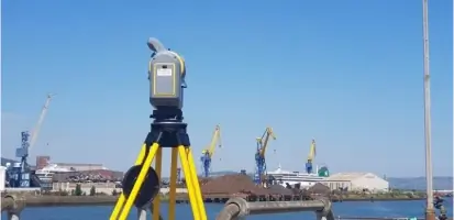
Our topographical surveys precisely map land features and terrain using advanced laser scanning technology. This critical data supports planning applications, construction projects, and land development across Northern Ireland. By linking surveys to the Ordnance Survey National Grid, we ensure absolute positional accuracy for seamless integration with official mapping systems.
Underground Utility Mapping
Using ground-penetrating radar and electromagnetic location scanning, we identify hidden pipes and cables beneath sites. Our same-day utility detection reports provide essential safety information for excavation projects. This service prevents costly damages while ensuring compliance with health and safety regulations during infrastructure development.
3D Model Conversion
We convert point cloud data into detailed 3D building models for architectural and engineering applications. Our BIM-compatible models support design validation and construction planning. These digital twins enable stakeholders to visualise projects in precise detail before physical work begins, reducing errors and saving costs.
BIM Surveying
Our BIM surveying creates intelligent 3D models that support entire project lifecycles from design to facility management. By integrating real-world data into digital workflows, we enhance collaboration between architects, engineers, and contractors. This approach improves decision-making and reduces rework during construction phases.
Dispute Visualisation
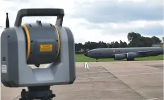
Using 3D laser scanning, we create visual evidence for property boundary and structural disputes. Our accurate digital models provide measurable proof in contentious situations. This service helps legal professionals and landowners resolve conflicts efficiently through clear, technical documentation.
Questions
What surveying services do you offer?
We provide topographical surveys, underground utility mapping, 3D model conversion, BIM surveying, and dispute visualisation services using advanced laser scanning technology.
How experienced are your surveyors?
Our team has 35 years of combined experience delivering precise surveying solutions across Northern Ireland, maintaining RICS accreditation standards throughout our operations.
Do you offer 3D modelling services?
Yes, we convert point cloud data into detailed 3D BIM models that support construction planning and facility management for architects and engineers.
What payment methods do you accept?
We accept payments via BACS transfers and cheques for our surveying services.
Which areas do you serve?
We operate across Belfast, Newcastle, Newry, Ballynahinch, and Armagh, providing surveying expertise to clients throughout Northern Ireland.
What are your business hours?
Our office is open Monday to Sunday from 09:00 to 17:00 for client consultations and survey coordination.