Business Details
Professional Land Surveyors and Engineering Services in the UK
Established over a decade ago, Geomatic Surveys has built a reputation for delivering comprehensive surveying and engineering solutions across the UK. Our expertise spans topographical and measured building surveys, 3D laser scanning, and flood risk assessments, serving architects, national house builders, and local governments. Utilising cutting-edge technology such as robotic total stations and GPS systems, we ensure precision and efficiency in every project.Our team's extensive experience in Cheshire, Lancashire, and Staffordshire, combined with nationwide capabilities, positions us to advise on diverse projects. Rigorous quality assurance processes and adherence to industry standards, including CSCS qualifications and full insurance coverage, underscore our commitment to excellence. Clients consistently return for our professionalism, technical proficiency, and tailored service delivery.
Services
Topographical Surveys
Measured Building Surveys
3D Laser Scanning
Flood Risk Assessments
Engineering Services
Highways Surveys
Highlights and features
- We utilise advanced robotic total stations and 3D laser scanning technology for precise data capture.
- Our surveyors hold CSCS qualifications and have over a decade of nationwide project experience.
- We provide tailored solutions for architects, developers, and local authorities across the UK.
- Rigorous quality assurance checks ensure data accuracy and client confidence.
- Our Trimble partnerships enable access to cutting-edge survey instrumentation.
Associations and certifications
- Construction Skills Certification Scheme (CSCS)
Services
Topographical Surveys
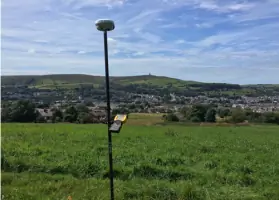
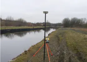
We conduct detailed topographical surveys at all scales, tailored to client requirements. Using robotic total stations and GPS systems, we map terrain features with high accuracy. Ideal for planning applications, construction projects, and environmental assessments across the UK.
3D Laser Scanning
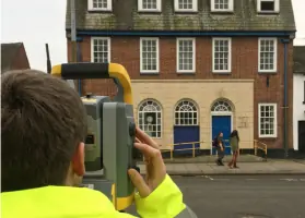
Our Trimble SX10 Scanning Total Station captures precise 3D data for complex structures. This technology enables efficient point cloud datasets and 3D models. Perfect for inaccessible buildings, industrial sites, and heritage projects requiring high-resolution spatial data.
Flood Risk Assessments
We produce detailed flood risk assessments using topographical surveys of watercourses and flood-prone areas. Data is formatted for modelling software to support planning applications. Our surveys meet Environment Agency requirements for accurate flood zone analysis.
Measured Building Surveys
We create accurate 'as-built' drawings for residential, commercial, and industrial properties. Surveys include internal and external features, supporting renovations, extensions, and compliance documentation. Delivered in CAD format for architectural and engineering use.
Engineering Services
Our engineering team provides setting-out services for house building, infrastructure, and industrial projects. We use coordinate data to establish precise construction points, with quality assurance checks and CAD checkplots. Services include section 38/104 submissions for local authorities.
People
Ian Holmes
Managing Director
Ian Holmes leads Geomatic Surveys with over a decade of experience in land surveying and engineering consultancy. He oversees project delivery, client relations, and strategic growth. His expertise spans topographical surveys, 3D laser scanning, and infrastructure projects across the UK.
Questions
What surveying services do you offer?
We provide topographical surveys, measured building surveys, 3D laser scanning, flood risk assessments, and engineering services for construction and planning projects.
Which areas do you cover?
We operate throughout the North West and nationally across the UK, including Cheshire, Lancashire, and Staffordshire.
What technology do you use?
We utilise robotic total stations, GPS systems, Trimble SX10 scanning technology, and CAD software for accurate data capture and analysis.
Are your surveyors qualified?
All surveyors hold CSCS qualifications and have extensive experience in diverse surveying environments.
How do you ensure data accuracy?
We conduct rigorous quality assurance checks and maintain professional indemnity insurance to guarantee survey precision.
Can you handle urgent projects?
Yes, we've completed time-sensitive projects like solar farm setting-out within six weeks while maintaining quality standards.